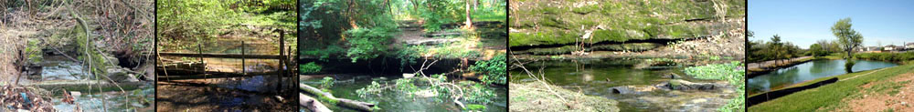
Wolf Run Trail of Springs Project Activities
Trail of Springs coordinators are working on a number of activities to feature community springs.
Maps and Displays:
We are working with Bluegrass Community and Technical College Environmental Science and Technology GIS faculty and students along with the Kentucky Geological Survey, Division of Water Groundwater Branch and LFUCG in developing a spring map that incorporates known spring locations (about 43), groundwater dye tracing data, recharge area delineations (where present), streets roads, and key landmarks. These map products will be printed in several forms:
Project coordinators are working with the staff at McConnell Springs in creating an attractive wall display for this poster and a distribution rack for the trail maps.
 Spring Markers:
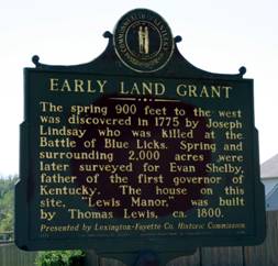
Several of our springs have historic markers associated with them (Preston , Lindsay, McConnell's and Kenton Blue Hole).
Our project would place an ADA compliant permanent outdoor plaque on post of up to 11X17 on a post that tells the name of the spring, its Kentucky Geological Survey Registry Number, and a map of the general re-charge area with narrative as space permits.
Stream Restoration Demonstration Projects
 Two of the springs have beenidentified for a demonstration restoration project (Gardenside Spring and Commonwealth Spring).
These springs were selected because they are currently undeveloped with trash, invasive plant and other issues, but have significant local interest in mounting a restoration and management effort.
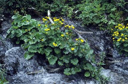
Pictured left: Marsh Marigold (Caltha palustris)
Restoration efforts will include:
1. Volunteer clean up day for trash removal;
2. Invasive plant removal where practical by landscape labor;
3. Introduction of native plants common to the area prior to settlement.
New research has provided insight on the native plant communities that were common around inner Bluegrass springs and seeps. Plant material can be secured from respected nurseries in Ohio or Indiana, with provenance recorded.
Small initial plantings can be tried to gauge potential success for various species. Marsh marigold and black ash could be tried in the more shady area around the springs. In the more sunny meadow below springs, species to be tried would include the northern anemone (A. canadensis), northern head-sedge (Carex vesicaria), broad-leaved meadow loosestrife (Lysimachia hybrida), feather-bells (Stenanthium gramineum), and western meadow-rue (Thalictrum dasycarpum).
Trail of Springs Day Wolf Run Springs Open House,
April 18, 2010, 1:00 - 4:00 PM
Starting at McConnell Springs Nature Center
The Trail of Springs Project will be kicked off with a "Spring Open House and Tour", advertised with a press release and coordinated with participating organizations. The tour will start at McConnell Springs with stops at Lindsay Springs, Kenton Blue Hole, Gardenside Springs, and Preston Springs.
Volunteers and expert interpreters are being recruited for selected springs along the way to provide narrative about the spring, its history, hydrology, water quality and potential. Participants may tour with an organized group, or travel on their own to sites of their choice. Round trip will be less than 12 miles, so the tour could be completed on bicycle within a few hours if participants desire.
Contact us if you want to register or volunteer for this tour, space is limited so please contact us early!